Extracting data from elevation certificates
Licensed surveyors and engineers complete FEMA's Elevation Certificate, on whichever edition of the form their software prints. Floodplain administrators keep one on file for every new or substantially improved building in a flood zone, and insurance agents use them to rate policies. They arrive as emailed PDFs, permit uploads and scans.
Floodplain review needs the community number, the map panel, the flood zone, the base flood elevation and the surveyed elevation of the lowest floor. The community's permit system compares the floor with the base flood elevation to confirm the building meets the floodplain ordinance.
What makes elevation certificates hard
Elevations compared across pages
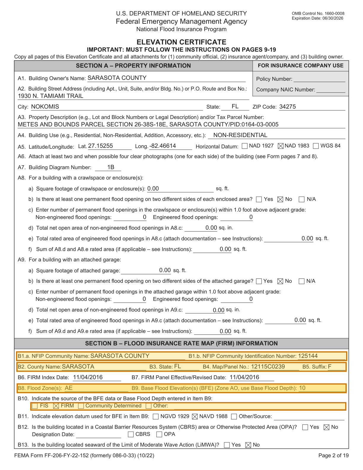
The base flood elevation in Section B is read against the surveyed floor and grade elevations in Section C, usually on the next page.
Numbered items on shared lines
Numbered items such as B9 and C2.a pack a caption and a value onto shared lines of small type, several items to a line.
Answers marked by checkbox
The vertical datum, the source of the base flood elevation and the building's construction status are each answered by a checked box.
Parse, extract, verify
Parse
Parse turns the document into reading-order Markdown and a hierarchy of blocks (text, tables, figures), and grounds each block to its exact location on the page.
Extract
You define the fields in a JSON schema, and Extract returns their values in a consistent, structured format, each linked back to where it appears in the Markdown.
Verify
Each value links back to where it appears, down to the character range in the Markdown, and the page and bounding box in the source document, so every result can be verified.
One elevation certificate, end to end
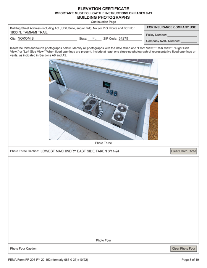
About this document: A completed FEMA Elevation Certificate for a county fire station in Nokomis, Florida, certified by a licensed surveying firm. Sarasota County posts it in its public floodplain records. Seven portrait pages: property and map data in Sections A and B, surveyed elevations and certification, Sections E to I, and two pages of photographs. Page 1 is featured. The surveyor's seal and digital signature were removed.
Processing objective: The objective is to read the flood map data for the building: its community, map panel and zone, and the base flood elevation with its source. A floodplain reviewer compares that elevation with the surveyed floor on the next page. Each value grounds to its line in Section B.
Demonstration fields: NFIP community ID, FIRM map panel, BFE source, Flood zone, Base flood elevation
The document
4 of 7 pages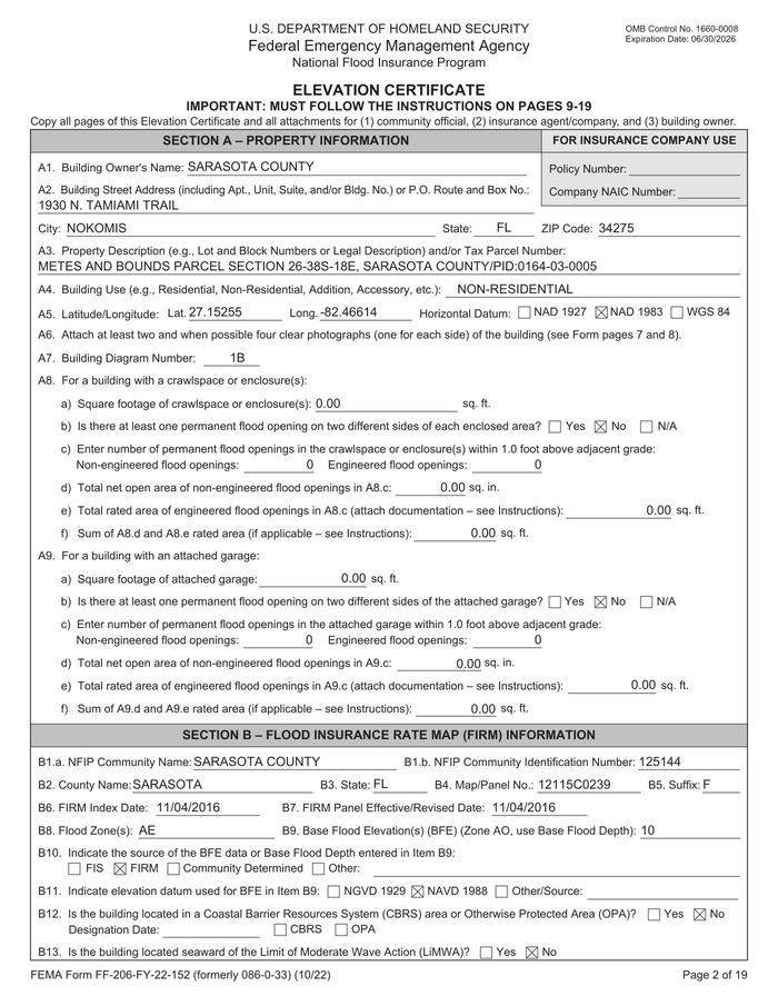 Page 1shown below
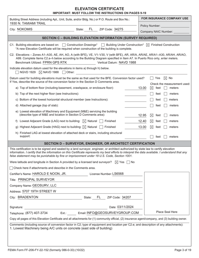 Page 2
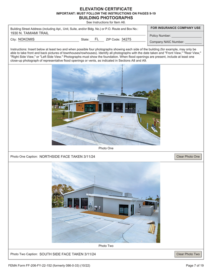 Page 6
 Page 7
Where each value came from
firm.nfip_community_id
{
  "value": "125144",
  "page": 1,
  "range": {
    "end": 2769,
    "start": 2718
  },
  "box": {
    "xmin": 0.04469,
    "ymin": 0.74786,
    "xmax": 0.95617,
    "ymax": 0.76797
  }
}firm.map_panel_number
{
  "value": "12115C0239",
  "page": 1,
  "range": {
    "end": 2842,
    "start": 2812
  },
  "box": {
    "xmin": 0.04504,
    "ymin": 0.77083,
    "xmax": 0.95493,
    "ymax": 0.79091
  }
}firm.bfe_source
{
  "value": "FIRM",
  "page": 1,
  "range": {
    "end": 3134,
    "start": 3126
  },
  "box": {
    "xmin": 0.08393,
    "ymin": 0.85571,
    "xmax": 0.95388,
    "ymax": 0.87361
  }
}firm.flood_zone
{
  "value": "AE",
  "page": 1,
  "range": {
    "end": 2964,
    "start": 2942
  },
  "box": {
    "xmin": 0.04627,
    "ymin": 0.81627,
    "xmax": 0.95469,
    "ymax": 0.83629
  }
}firm.base_flood_elevation
{
  "value": 10,
  "page": 1,
  "range": {
    "end": 3035,
    "start": 2965
  },
  "box": {
    "xmin": 0.04627,
    "ymin": 0.81627,
    "xmax": 0.95469,
    "ymax": 0.83629
  }
}
How to try it yourself
Everything on this page is reproducible. The sample, its schema, and the Parse and Extract API outputs are published. You can repeat the same two calls from whichever surface you already build on.
- Claude Skilldescribe the job; the agent writes it
- CLIno code at all
- MCPexpose ADE docs as an agent tool
- REST APIany language
- Pythonlandingai-ade
- TypeScriptlandingai-ade
Documents into data
Accurate
The best accuracy on the difficult documents other tools get wrong, such as messy scans, complicated tables, checkboxes and handwriting.
Auditable
Every answer cites its sources. Values come back with an audit trail (page, bounding box, character range) so a human can review them.
Agentic
Applies multi-step reasoning, and plans before it acts. Handles documents it has never seen before and adapts to variations.
API-first
Composable APIs that drop into any tech stack and can be called from anywhere. Easy to build on and embed in your pipelines and products.
Affordable
Cost-competitive rates with complete price transparency. Spend controls before you run, and every job reports its exact cost.
Enterprise-grade
Built for production and scale from day one. Fully observable and monitored, running securely in our cloud or yours.
Built for high-volume, high-throughput production
- Zero data retention
- Priority rate limits
- Enhanced support
- VPC and on-prem deployment
Available on Team and Enterprise plans. VPC and on-prem deployment require an Enterprise plan.